


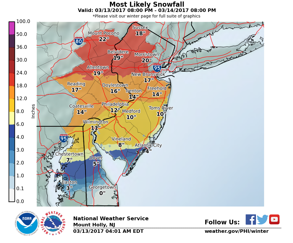
 The likeliest snow total for the Greater Red Bank Green: 10 to 14 inches, according to the National Weather Service. (Click to enlarge)
By JOHN T. WARD
 Entering the final week of winter 2017, the Greater Red Bank Green is in for a strong blast of winter, according to the National Weather Service, which issued a blizzard warning Monday morning.
After a mostly sunny day with peak temperatures around 33 degrees, Monday night is expected to bring snow, heavy at times, that continues through most of Tuesday, leaving anywhere from four to 20 inches. The likeliest outcome for the Greater Red Bank Green is around 14 inches, according to the forecast issued at 5 a.m. Monday.
Along with the snow, expect coastal flooding, wind gusts as strong as 60 miles per hour, limited driving visibility and possible power outages.
Red Bank Borough, citing a new snow emergency parking ordinance, has ordered all vehicles be removed from roadways during the snowfall and until streets have been cleared curb to curb.
From the announcement:
As such, if the current forecast continues, residents should plan to have their vehicles off all roadways from Monday evening until at least Wednesday morning depending on the timing and amount of snowfall. Residents who do not have off street parking may park their vehicles in any municipal parking lot. Overnight parking and metered parking will not be enforced in the Municipal lots until the snow emergency has ended. Once the snow has ended and your street is plowed curb to curb, please remove vehicles from the Municipal lots so they may be properly cleared.


