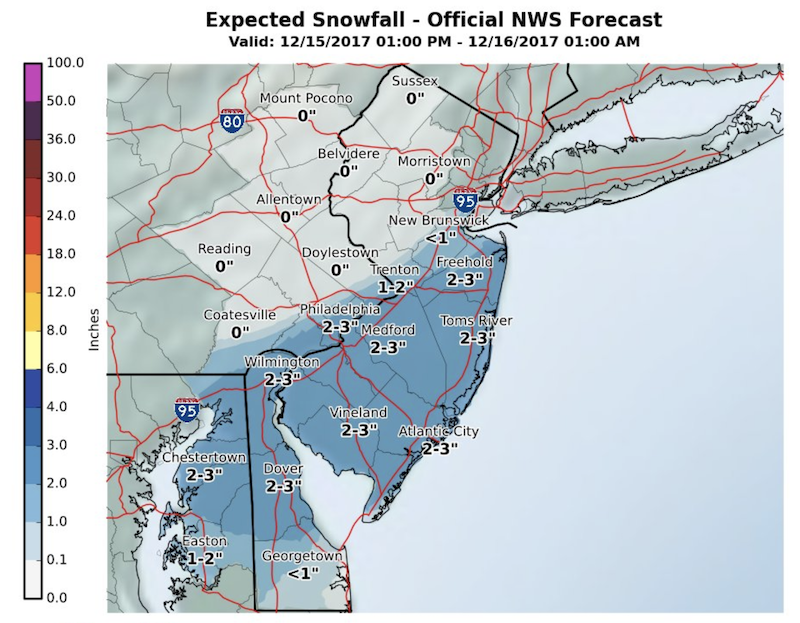
 A third late-autumn snowfall in the span of a week could lay up to three inches on the Greater Red Bank Green starting late Friday afternoon, according to the National Weather Service. (Click to enlarge.)
Click ‘read more’ for dull details on the weekend and beyond, weatherwise.
Friday
Snow likely, mainly after 4pm. Mostly cloudy, with a high near 33. Calm wind becoming north around 6 mph in the afternoon. Chance of precipitation is 60%. Total daytime snow accumulation of 1 to 3 inches possible.
Friday night
Snow likely, mainly before 10pm. Cloudy during the early evening, then gradual clearing, with a low around 28. Breezy, with a west wind 7 to 12 mph increasing to 15 to 20 mph after midnight. Chance of precipitation is 60%. New snow accumulation of less than one inch possible.
Saturday
Mostly sunny, with a high near 39. West wind 16 to 18 mph, with gusts as high as 28 mph.
Saturday Night
Mostly cloudy, with a low around 26. North wind 8 to 11 mph.
Sunday
Mostly sunny, with a high near 40. North wind around 6 mph becoming light and variable in the afternoon.
Sunday Night
A chance of rain before 1am, then a slight chance of rain and snow. Mostly cloudy, with a low around 33. Chance of precipitation is 30%. New precipitation amounts of less than a tenth of an inch possible.
Monday
Partly sunny, with a high near 49.
Monday Night
Mostly cloudy, with a low around 37.
Tuesday
Partly sunny, with a high near 51.
Tuesday Night
Partly cloudy, with a low around 35.
Wednesday
Sunny, with a high near 43. Breezy.
Wednesday Night
Mostly clear, with a low around 28.
Thursday
Mostly sunny, with a high near 45.