


 Streets and roads on the Greater Red Bank Green were just beginning to get covered in wet snow at 6 a.m. Tuesday as the third coastal storm in two weeks arrived.
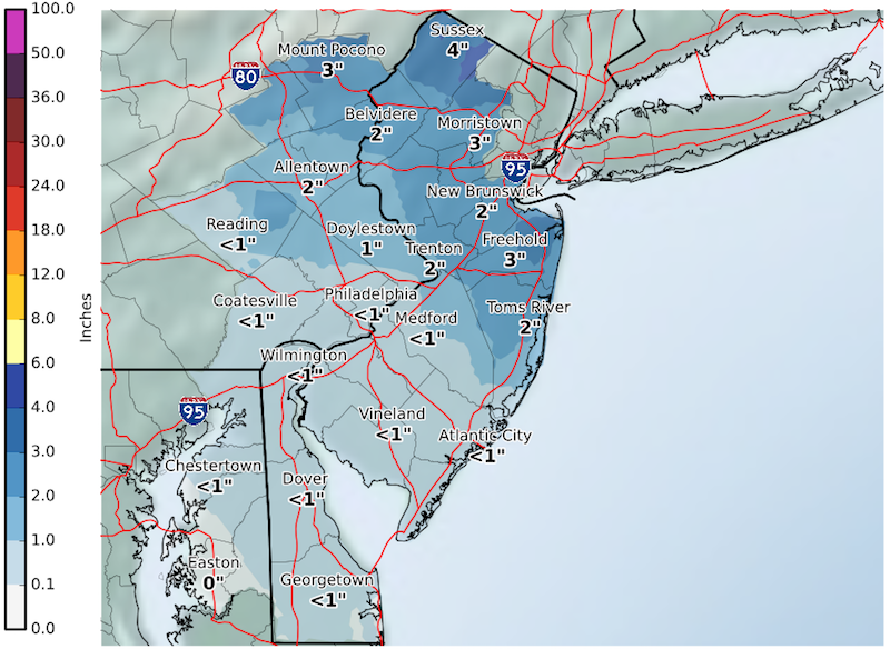
Slippery conditions were expected for the morning commute as our area gets up to three inches, according to the National Weather Service. Schools on the Green announcing two-hour delays as of 5:45 a.m. included Red Bank, Red Bank Regional and Red Bank Charter.
Here’s the extended weather forecast.
Tuesday
Snow before noon, then a chance of rain showers. High near 43. Breezy, with a northwest wind around 22 mph, with gusts as high as 36 mph. Chance of precipitation is 100%. New snow accumulation of 1 to 3 inches possible.
Tuesday Night
Partly cloudy, with a low around 29. West wind around 17 mph, with gusts as high as 28 mph.
Wednesday
Scattered rain and snow showers after 2pm. Partly sunny, with a high near 43. Breezy, with a west wind 20 to 23 mph, with gusts as high as 38 mph. Chance of precipitation is 40%. Little or no snow accumulation expected.
Wednesday Night
Scattered rain and snow showers before 10pm, then a slight chance of snow showers between 10pm and 2am. Mostly cloudy, with a low around 30. Breezy, with a west wind 23 to 25 mph, with gusts as high as 43 mph. Chance of precipitation is 30%. Little or no snow accumulation expected.
Thursday
Isolated showers after 2pm. Partly sunny, with a high near 47. Chance of precipitation is 20%.
Thursday Night
Partly cloudy, with a low around 29.
Friday
Mostly sunny, with a high near 40.
Friday Night
Partly cloudy, with a low around 26.
Saturday
Sunny, with a high near 43.
Saturday Night
Partly cloudy, with a low around 30.
Sunday
Mostly sunny, with a high near 52.
Sunday Night
Partly cloudy, with a low around 34.
Monday
Partly sunny, with a high near 46.


