 Labor Day is past, but summer steamrolls on Tuesday, when heat and humidity are expected to yet again yield a combined index of 100 in the area that includes the Greater Red Bank Green.
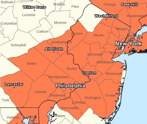
The National Weather Service has issued a heat advisory for the region from 11 a.m. to 7 p.m.
Check out the extended forecast below. (NWS graphic. Click to enlarge.)
Tuesday
Mostly sunny, with a high near 91. Northwest wind around 6 mph becoming calm in the morning.
Tuesday Night
Partly cloudy, with a low around 73. Southeast wind around 6 mph.
Wednesday
Mostly sunny, with a high near 83. Southeast wind 3 to 8 mph.
Wednesday Night
Partly cloudy, with a low around 73. South wind 6 to 9 mph.
Thursday
A chance of showers and thunderstorms after 2pm. Mostly sunny, with a high near 89. South wind 5 to 8 mph. Chance of precipitation is 40%. New rainfall amounts of less than a tenth of an inch, except higher amounts possible in thunderstorms.
Thursday Night
A chance of showers and thunderstorms. Mostly cloudy, with a low around 71. Chance of precipitation is 40%. New rainfall amounts of less than a tenth of an inch, except higher amounts possible in thunderstorms.
Friday
A chance of showers, with thunderstorms also possible after 2pm. Mostly cloudy, with a high near 78. Chance of precipitation is 30%.
Friday Night
A chance of showers and thunderstorms. Mostly cloudy, with a low around 67. Chance of precipitation is 40%.
Saturday
Mostly cloudy, with a high near 74.
Saturday Night
A chance of showers after 8pm. Mostly cloudy, with a low around 64. Chance of precipitation is 30%.
Sunday
A chance of showers and thunderstorms. Mostly cloudy, with a high near 76. Chance of precipitation is 30%.
Sunday Night
A chance of showers and thunderstorms. Mostly cloudy, with a low around 67. Chance of precipitation is 40%.
Monday
A chance of showers and thunderstorms. Partly sunny, with a high near 80. Chance of precipitation is 30%.