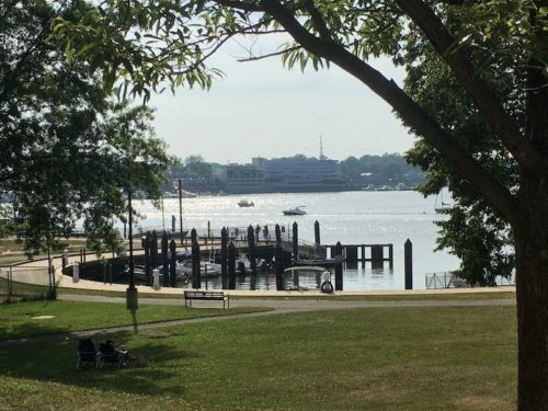
 Sunlight danced on the Navesink River, as seen from Marine Park in Red Bank Sunday afternoon, capping a summery Fourth of July holiday weekend.
The workweek gets underway Monday with more sunshine, and temperatures in the low 90s, but followed by possible thunderstorms in the evening, according to the National Weather Service. Check out the extended forecast below. (Photo by John T. Ward. Click to enlarge.)Monday
Showers and thunderstorms likely, mainly after 5pm. Some storms could be severe, with hail, gusty winds, heavy rain, and frequent lightning. Increasing clouds, with a high near 90. Light and variable wind becoming southeast 5 to 10 mph in the afternoon. Chance of precipitation is 60%. New rainfall amounts between a quarter and half of an inch possible.
Monday Night
Showers and thunderstorms likely, mainly before 9pm. Some storms could be severe, with large hail, hail, damaging winds, gusty winds, heavy rain, and frequent lightning. Patchy fog after 2am. Otherwise, mostly cloudy, with a low around 70. Southeast wind around 5 mph becoming calm in the evening. Chance of precipitation is 60%. New rainfall amounts between a tenth and quarter of an inch, except higher amounts possible in thunderstorms.
Tuesday
A chance of showers and thunderstorms, mainly after 2pm. Some of the storms could produce heavy rainfall. Patchy fog before 8am. Otherwise, partly sunny, with a high near 84. Light southeast wind increasing to 5 to 10 mph in the morning. Chance of precipitation is 30%. New rainfall amounts of less than a tenth of an inch, except higher amounts possible in thunderstorms.
Tuesday Night
A chance of showers and thunderstorms, mainly before 8pm. Some of the storms could produce heavy rainfall. Mostly cloudy, with a low around 72. South wind around 5 mph. Chance of precipitation is 30%. New rainfall amounts of less than a tenth of an inch, except higher amounts possible in thunderstorms.
Wednesday
A chance of showers and thunderstorms, mainly after 2pm. Partly sunny, with a high near 86. South wind 5 to 10 mph. Chance of precipitation is 30%. New rainfall amounts of less than a tenth of an inch, except higher amounts possible in thunderstorms.
Wednesday Night
A chance of showers and thunderstorms before 8pm. Partly cloudy, with a low around 72. Chance of precipitation is 30%. New precipitation amounts of less than a tenth of an inch, except higher amounts possible in thunderstorms.
Thursday
Mostly sunny, with a high near 86.
Thursday Night
Partly cloudy, with a low around 73.
Friday
A chance of showers, with thunderstorms also possible after 8am. Partly sunny, with a high near 85. Chance of precipitation is 40%.
Friday Night
A chance of showers before 2am. Mostly cloudy, with a low around 73. Chance of precipitation is 30%.
Saturday
A chance of showers and thunderstorms. Partly sunny, with a high near 87. Chance of precipitation is 40%.
Saturday Night
A chance of showers and thunderstorms. Mostly cloudy, with a low around 73. Chance of precipitation is 30%.
Sunday
A chance of showers and thunderstorms. Mostly sunny, with a high near 87. Chance of precipitation is 40%.