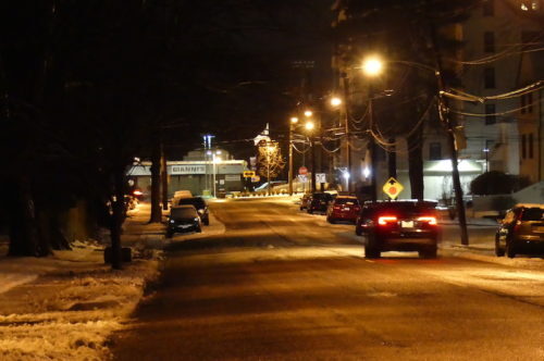
 Roads on the Greater Red Bank Green were clear before dawn Monday as a storm left just a fraction of the four-to-seven inches of anticipated snow overnight. Melt-off was well underway with temperatures in the mid-30s.
The forecast prompted a statewide state of emergency declaration by New Jersey Governor Phil Murphy, his fourth of 2019, and delayed-opening plans by area schools.
The National Weather Service forecast for Monday calls for cloudy skies giving way to some sunshine and peak temperatures in the low 40s. Check out the extended forecast below. (Photos by John T. Ward. Click to enlarge.)
Monday
Cloudy, then gradually becoming mostly sunny, with a high near 41. Northwest wind around 17 mph.
Monday night
Partly cloudy, with a low around 20. West wind 11 to 16 mph.
Tuesday
Sunny, with a high near 32. West wind 9 to 13 mph.
Tuesday night
Partly cloudy, with a low around 17. West wind 14 to 16 mph.
Wednesday
Mostly sunny, with a high near 26. Blustery.
Wednesday night
Partly cloudy, with a low around 14.
Thursday
Sunny, with a high near 31.
Thursday night
Partly cloudy, with a low around 21.
Friday
Partly sunny, with a high near 36.
Friday night
A chance of snow. Mostly cloudy, with a low around 28. Chance of precipitation is 30%.
Saturday
Partly sunny, with a high near 40.
Saturday night
A chance of rain. Mostly cloudy, with a low around 34. Chance of precipitation is 40%.
Sunday
A chance of rain. Mostly cloudy, with a high near 45. Chance of precipitation is 50%