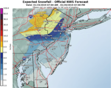
With a major storm threatening the northeastern United States, here’s what we can expect in coming days, according to the National Weather Service.
Friday: A light, accumulating snow was falling as dawn approached Friday, and was expected to taper off by midmorning, with temperatures reaching 41 degrees or so.
Saturday: Some rain before 2 p.m., shifting to a mix of rain and snow, with new snow accumulation of less than a half an inch.
Saturday night: Rain, heavy at times, with perhaps another half inch of snow.
Sunday: Rain before noon, then snow, with temperatures peaking in the mid-30s. New precipitation amounts between a quarter and half of an inch possible.
Sunday night: Chance of snow is only around 30 percent, as temperatures plummet to as low as 8 degrees and winds pick up.”This may result in a flash freeze of wet surfaces,” the NWS warned. Falling limbs and power outages are possible.
Monday, Martin Luther King Jr. Day: Mostly sunny and blustery, with a high near 17 degrees.
Monday night: Mostly clear, with a low around 11. Blustery.
Tuesday: Mostly sunny, with a high near 32.
(Photo by John T. Ward. Click to enlarge.)


