


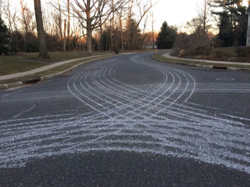
 Liquid-brine prep work for an expected snowstorm left some artistic designs on the pavement in Fair Haven Saturday.
The Greater Red Bank Green could see accumulations of between 7 and 14 inches of snow in a storm expected to begin Sunday afternoon and continue into Tuesday morning, according to the National Weather Service.
Along with winds gusting up to 40 miles per hour and threats of power outages and coastal flooding, road travel is expected to be “difficult to impossible,” the NWS says.
Red Bank’s government has issued a parking alert; see below, along with the extended forecast for the region below. (Photos by John T. Ward. Click to enlarge.)
 bThe National Weather Service probable snow-accumulation estimates as of early Sunday. (NWS map. Click to enlarge.)
Here’s an excerpt fromRed Bank’s alert:
As always, per municipal ordinances, an on-street parking prohibition exists on all roads in the event of snow accumulation to allow for plowing and the passage of emergency vehicles. Vehicles parked in the streets may be ticketed and/or towed. Residents without driveways/garages may park vehicles in the East Side Municipal Parking Lots (Mechanic Street & Wallace Street) & Count Basie Fields Parking Lot. Property owners must clear their sidewalks within 24 hours after the conclusion of snow fall. Do not plow, blow or shovel snow into the streets.
Forecast:
Sunday
A chance of snow, mainly after 2pm. Cloudy, with a high near 30. East wind 5 to 10 mph. Chance of precipitation is 40%. Total daytime snow accumulation of less than a half inch possible.
Sunday Night
Snow. Low around 29. Blustery, with an east wind 10 to 15 mph increasing to 20 to 25 mph after midnight. Chance of precipitation is 100%. New snow accumulation of 5 to 9 inches possible.
Monday
Rain and snow, becoming all snow after 4pm. The snow could be heavy at times. High near 34. Windy, with a northeast wind 25 to 30 mph, with gusts as high as 40 mph. Chance of precipitation is 100%. New snow accumulation of 3 to 7 inches possible.
Monday Night
Rain and snow before 1am, then snow and sleet between 1am and 4am, then snow after 4am. The snow could be heavy at times. Low around 30. Windy, with a northeast wind 20 to 30 mph, with gusts as high as 40 mph. Chance of precipitation is 90%. New snow and sleet accumulation of 1 to 3 inches possible.
Tuesday
Rain and snow before 1pm, then a chance of rain between 1pm and 4pm, then a chance of rain and snow after 4pm. High near 37. Breezy, with a north wind 15 to 20 mph. Chance of precipitation is 80%. New snow accumulation of less than a half inch possible.
Tuesday Night
A chance of snow before 7pm. Mostly cloudy, with a low around 28. Chance of precipitation is 30%.
Wednesday
Partly sunny, with a high near 36. Breezy.
Wednesday Night
Partly cloudy, with a low around 25.
Thursday
Sunny, with a high near 40.
Thursday Night
Mostly cloudy, with a low around 31.
Friday
A chance of rain and snow. Mostly cloudy, with a high near 46. Chance of precipitation is 30%.
Friday Night
A chance of rain and snow. Mostly cloudy, with a low around 33. Chance of precipitation is 40%.
Saturday
A chance of rain and snow. Mostly cloudy, with a high near 44. Chance of precipitation is 30%.
If you value the news coverage provided by redbankgreen, please become a paying member. Click here for details about our new, free newsletter and membership information.


