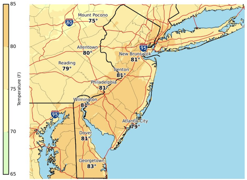
 Another warm day is expected Tuesday, with temperatures on the Greater Red Bank Green peaking at about 80 degrees, according to the National Weather Service. But drier air should make it more comfortable than its been the last two days, and sunshine will be back, for a day at least. (Click to enlarge.)
Here’s the extended forecast:
Today
Patchy fog before 8am. Otherwise, mostly sunny, with a high near 79. Northwest wind 6 to 8 mph.
Tonight
Partly cloudy, with a low around 62. North wind around 7 mph.
Wednesday
Showers likely, mainly after 2pm. Increasing clouds, with a high near 73. East wind 9 to 13 mph. Chance of precipitation is 60%. New precipitation amounts between a tenth and quarter of an inch possible.
Wednesday Night
A chance of showers. Cloudy, with a low around 58. Breezy, with a northeast wind 15 to 20 mph. Chance of precipitation is 50%. New precipitation amounts between a tenth and quarter of an inch possible.
Thursday
A chance of showers. Mostly cloudy, with a high near 65. Northeast wind around 18 mph. Chance of precipitation is 30%. New precipitation amounts of less than a tenth of an inch possible.
Thursday Night
A slight chance of showers. Mostly cloudy, with a low around 56. Chance of precipitation is 20%.
Friday
Mostly cloudy, with a high near 68.
Friday Night
A chance of showers. Mostly cloudy, with a low around 60. Chance of precipitation is 30%.
Saturday
Partly sunny, with a high near 74.
Saturday Night
Partly cloudy, with a low around 62.
Sunday
Mostly sunny, with a high near 79.
Sunday Night
Partly cloudy, with a low around 61.
Monday
A chance of showers. Partly sunny, with a high near 72. Chance of precipitation is 30%.