 Just two days after its first snowfall in more than year, the Greater Red Bank Green is in for more Friday, according to the National Weather Service.
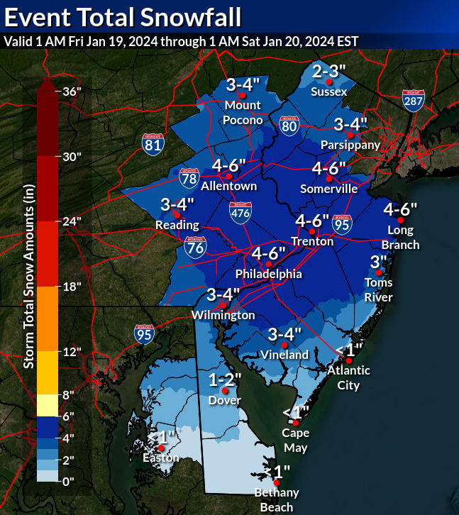
With “heavy snow and/or sleet accumulation,” the region can expect 3 to 5 inches between 4 a.m. and 10 p.m., the agency said in a forecast early Thursday.
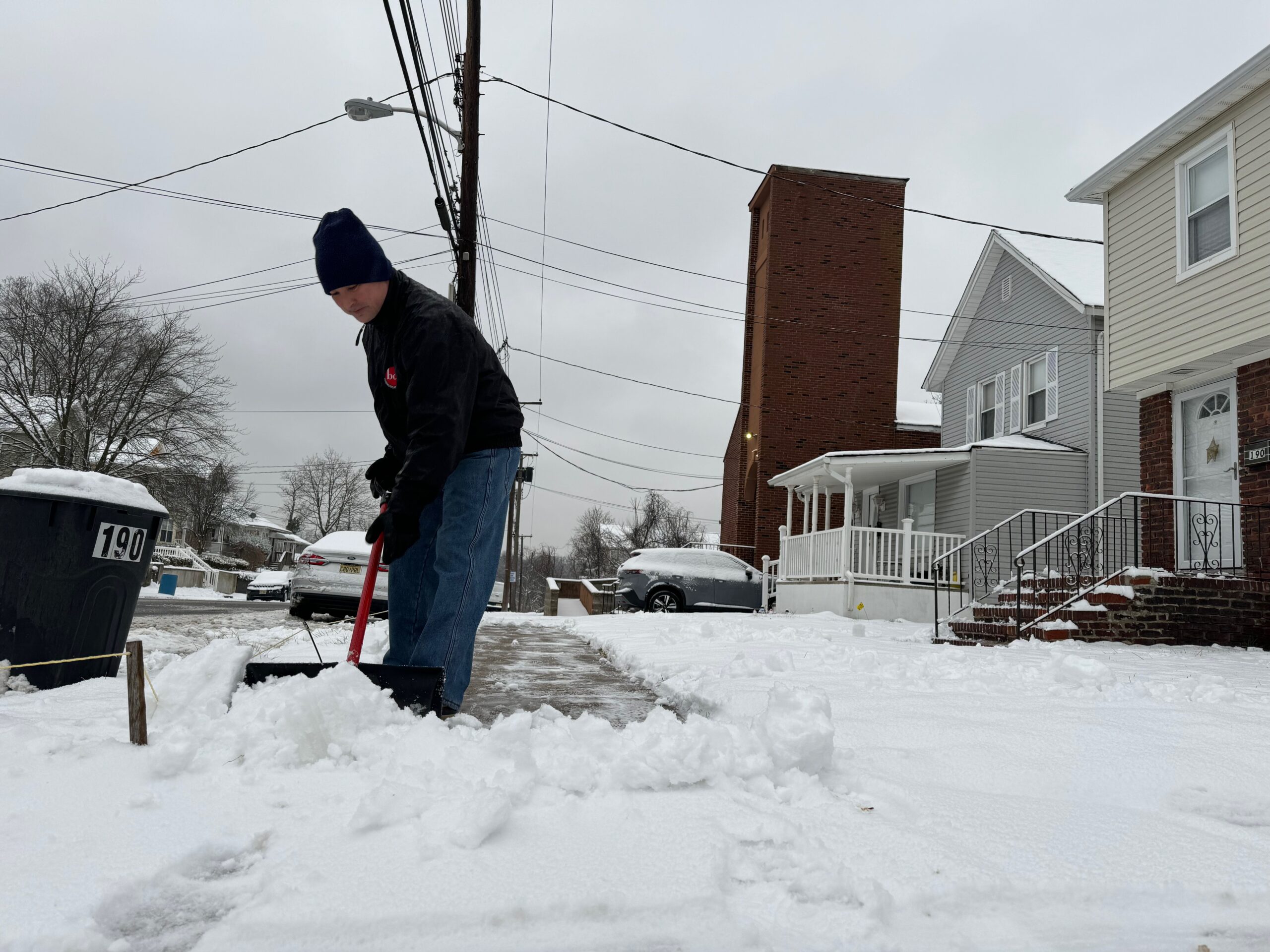
Check out the extended forecast below. (Photo by Brian Donohue; NWS graphic. Click to enlarge.)
Thursday
Mostly cloudy, with a high near 33. West wind 5 to 10 mph, with gusts as high as 20 mph.
Thursday Night
A slight chance of snow after 4am. Cloudy, with a low around 29. Southwest wind around 5 mph becoming calm. Chance of precipitation is 20%.
Friday
Snow, mainly after 8am. High near 33. Northeast wind 5 to 15 mph. Chance of precipitation is 100%. New snow accumulation of 3 to 5 inches possible.
Friday Night
Snow, mainly before 11pm. Low around 18. North wind 10 to 15 mph. Chance of precipitation is 90%. New snow accumulation of 1 to 2 inches possible.
Saturday
Partly sunny, with a high near 26. Blustery, with a northwest wind 15 to 20 mph, with gusts as high as 30 mph.
Saturday Night
Mostly cloudy, with a low around 15. Blustery.
Sunday
Sunny, with a high near 31. Blustery.
Sunday Night
Mostly clear, with a low around 18.
Monday
Mostly sunny, with a high near 36.
Monday Night
Mostly cloudy, with a low around 28.
Tuesday
Partly sunny, with a high near 43.
Tuesday Night
Cloudy, with a low around 33.
Wednesday
A chance of rain. Mostly cloudy, with a high near 44. Chance of precipitation is 40%.
If you value the news coverage provided by redbankgreen, please become a financial supporter for as little as $1 per month. Click here to set your own level of monthly or annual contribution.